

Beep-beep-beep! Little did we know at the time that we would be using the horn more than we could have imagined now that we were entering the Peruvian Andes. We departed the desert coastal region and the Pan Americana for our entre into the mountains on what became the first of many “scenic routes” during our drive through Peru. We began gaining elevation on the gravel road to the north of the Rio Santa, enjoying the sights of the canyon while wondering how on earth we missed the entrance to the nicely paved road on the other side of the river. Oh well, too late we told ourselves and proceeded the 30 or so miles to the bridge which connected to the other side.
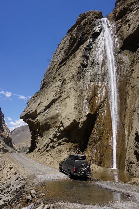
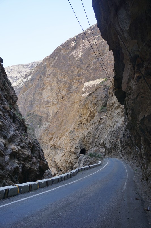
When did the famous Canyon del Pato begin we wondered? Soon it became clear that as beautiful as the drive had been so far, THE CANYON was just beginning. The sweaty palm producing single paved (thankfully) lane meandered like a snake on a path cut out of sheer rock over a gorge plummeting 3,000 feet. We passed through 35 single lane dark tunnels hand cut through solid stone while beeping the horn and flashing on the bright lights to warn any oncoming drivers. Enormous crude bedrock walls towered above us on both sides. Only later we learned that this is where the Cordillera Blanca and the Cordillera Negra meet to within hand holding distance for the small distance of only 50 feet apart in some places and plunging to great depths- all without guard rails!
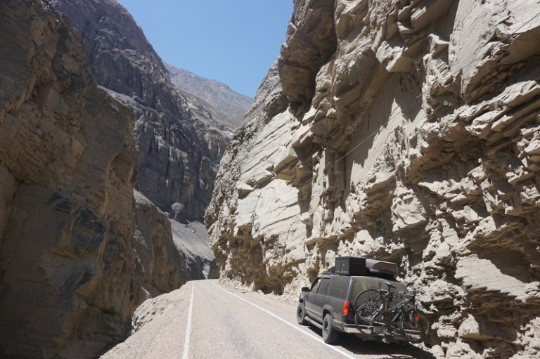

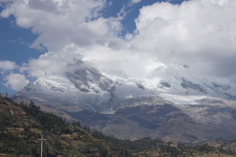
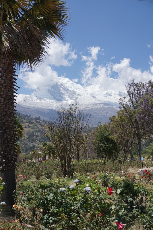
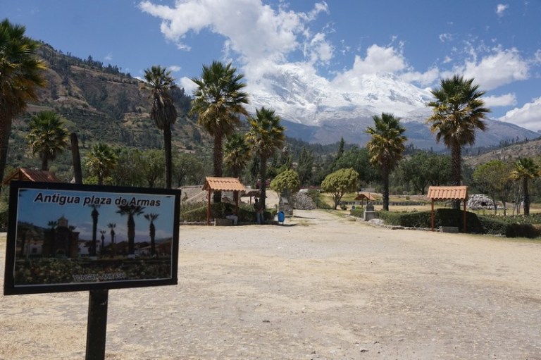
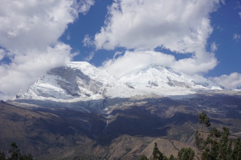
Much more of one of the most breathtaking parts of South America, the Cordillera Blanca would envelope us in the coming days. It is the world’s highest tropical mountain range and includes some of the continent’s highest mountains including Nevado Huascaran, Peru’s highest at over 22,000 feet. On the other side of the vertigo inducing gorge was the little sibling Cordillera Negra which exists in the shadows of its big brother range, the Cordillera Blanca to the east with towering glaciated peaks blocking the morning sun and lord over everything around them. The ‘Black Range,’ is nothing to sneeze at and is an impressive dark mountain range with sizable peaks but it is often overlooked sitting right across the valley in stark contrast to the gorgeous ‘White Range,’ with its stunning glaciated and craggy profile.


About 2 km south of the small village of Yungay we stopped at Campo Santo or Yungay Viejo (Old Yungay) which marks the site of the single worst natural disaster in Andean history. On May 31, 1970 an almost 8.0 magnitude earthquake sent a shock-wave clear to Mount Huascaran, Peru’s highest mountain, loosening an estimated 50 million cubic meters of snow, ice and rock from its north flank. The resulting aluvion (debris landslide) dropped over three vertical kilometers and traveled 15 kilometers at speeds of up to 335 km (240 miles) per hour burying Yungay and about 25,000 of its inhabitants all in about three minutes.
With the sun shining and lush green hills on all sides we approached the stillness of the well-manicured graveyard garden. There was a palpable peace in the air and the scent of the rosebushes planted in a sea over much of the site wafted over us. As we peered up to the fantastic glacier looming above the memorial, we imagined the vibrant town of thousands going about their daily lives who were now buried 8 to 12 meters beneath our feet. An overwhelming sense of sadness enveloped me and an uncontrollable flood of tears poured forth as we silently, slowly walked through these hallowed grounds.


Wow breath taking views… OMGOSH how terrible… the speed in which the landslide traveled… UNREAL… It sounds like it’s Holy Ground today
LikeLike
driving your car was balls to the wall, and Oh My what if the engine broke down, and ya always have to look for falling rocks above. No probs, God takes care of her own. The Andes are breathtaking, and I’m wondering how your carburator held up at 14,000 feet.
LikeLike
These new fangled carburetors are set up to handle anything (even in 1998)!
LikeLike